Long time ago, village limits in rural areas were drawn for convenience and surveyors probably asked people: “where does your village end?” And people would point to far-away locations. It did not matter where the village actually ended because there were fewer people compared to today.
It did not matter for wildlife either. Wildlife was everywhere and could easily cross the “village territories” because those were mostly empty. But with population explosion, as everywhere in the world, things have changed. Homes and farms reached the village limits. And some people even illegally acquired land beyond the village limits.
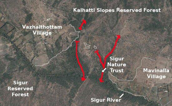
This has happened and is still happening in the Sigur Region. In the 1960s, E.R.C. Davidar observed that only private lands remained between Vazhaithottam and Mavinhalla as shown in the following picture. And if nothing was done, the villages would coalesce and would locally block the north-south circulation of wildlife.
Corridor
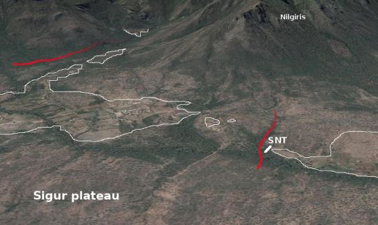
In order to avoid the blockage between the Sigur Reserved Forest and the Kalhatti Slopes Reserved Forest E.R.C. Davidar decided to purchase land and start protecting the area. You can see for yourself in a recent Google image that this 50 years effort has been effective.

Corridor perspective

